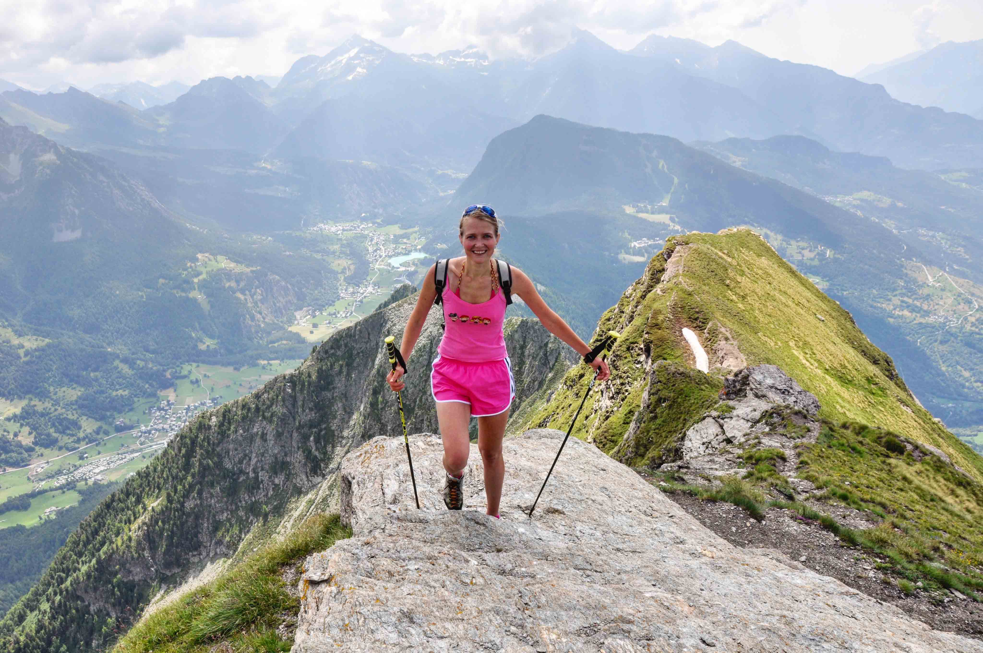
Pila (Aosta)
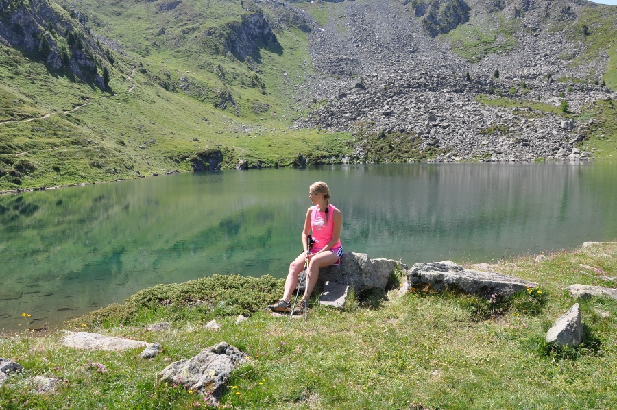
Pila (1800m) - Chamolé lake (2325m)
 Excellent hiking route for beginners and well prepared trekkers who want to do an acclimatization before more serious climbing.
Starting in Pila at an altitude of 1800 m. (it is possible to get from Aosta to Pila by car or on a cable car for 6 euros go/back), we trek up for about 1.40 hours through alpine meadows covered by flowers, rivers, small forest til we get to the Chamolé lake (2325m), where you can stop for a rest.
Elevation: + 525m (Pila - Chamolé lake)
Time going up: 1.40 hours (Pila - Chamolé lake)
Excellent hiking route for beginners and well prepared trekkers who want to do an acclimatization before more serious climbing.
Starting in Pila at an altitude of 1800 m. (it is possible to get from Aosta to Pila by car or on a cable car for 6 euros go/back), we trek up for about 1.40 hours through alpine meadows covered by flowers, rivers, small forest til we get to the Chamolé lake (2325m), where you can stop for a rest.
Elevation: + 525m (Pila - Chamolé lake)
Time going up: 1.40 hours (Pila - Chamolé lake)
Chamolé lake (2325m) - Col Replan (2373m)
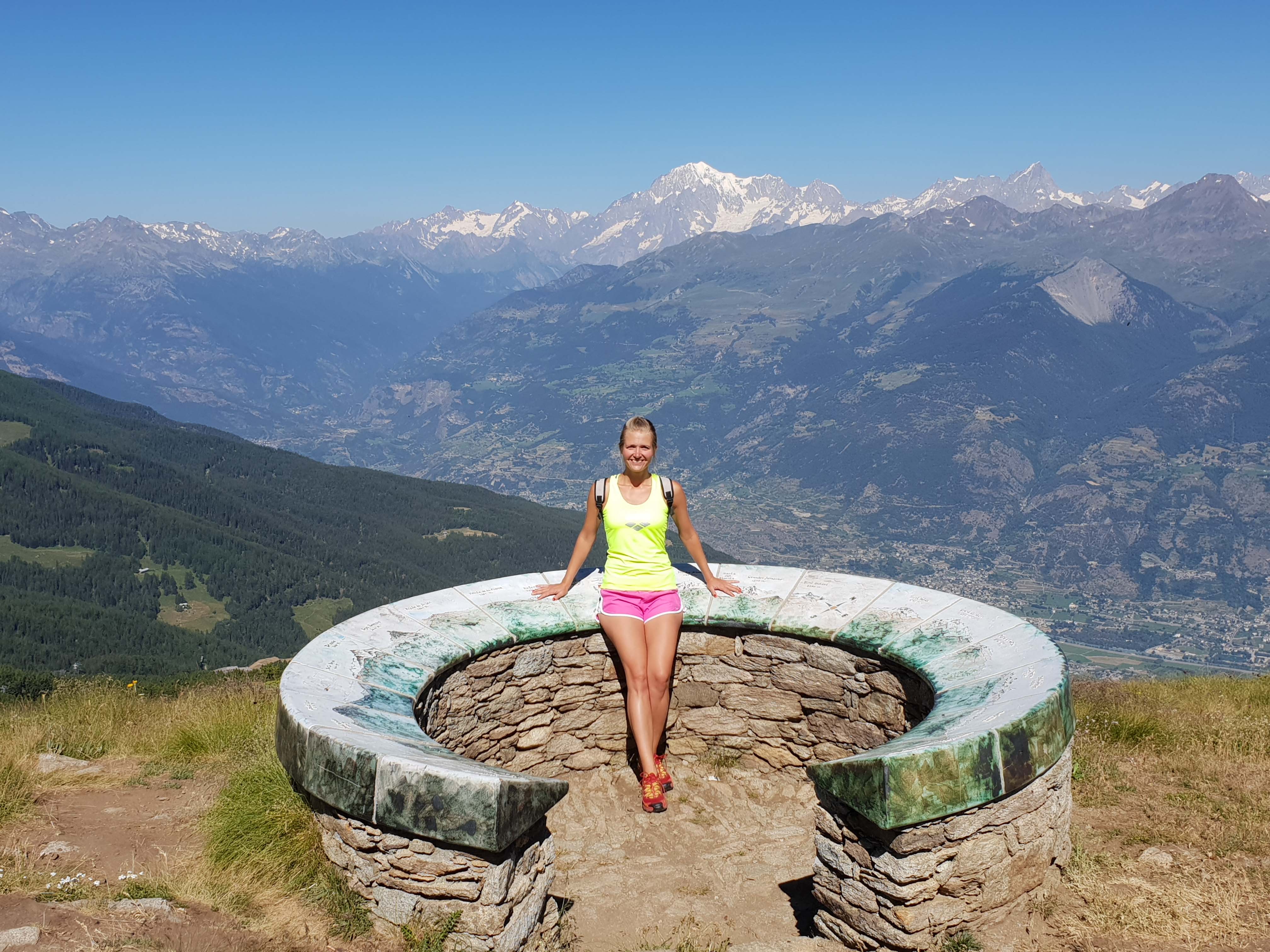 If you feel tired, you can end the route at the lake, but we would suggest to climb up to Col Replan (2373m), where you can admire the stunning views of the main peaks of the region (4810m Mont Blanc, Cervino / Matterhorn 4478m, Grand Combin 4314).
The ascent will take about 30 minutes.
Elevation: + 48m (Chamolé lake - Col Replan)
Time going up: 30 min (Chamolé lake - Col Replan)
If you feel tired, you can end the route at the lake, but we would suggest to climb up to Col Replan (2373m), where you can admire the stunning views of the main peaks of the region (4810m Mont Blanc, Cervino / Matterhorn 4478m, Grand Combin 4314).
The ascent will take about 30 minutes.
Elevation: + 48m (Chamolé lake - Col Replan)
Time going up: 30 min (Chamolé lake - Col Replan)
Chamolé lake (2325m) - Rifugio Arbolle (2511m)
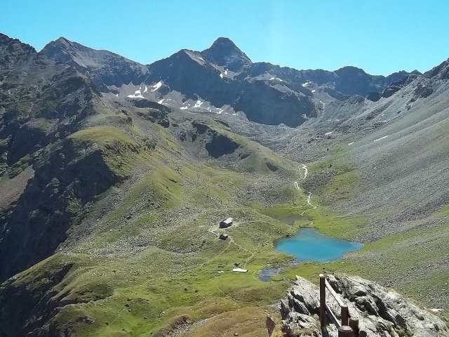 After having rest on a Chamolé lake (2325m) the journey is continues until the Arbolle refuge (2511m).
The section till colle di Chamolé (2641m) is quite steep and it takes about 45 min. From the hill it takes about 20 minutes to get to refuge.
Elevation: +316m - 130m
Time to going up: 1,10 h.
After having rest on a Chamolé lake (2325m) the journey is continues until the Arbolle refuge (2511m).
The section till colle di Chamolé (2641m) is quite steep and it takes about 45 min. From the hill it takes about 20 minutes to get to refuge.
Elevation: +316m - 130m
Time to going up: 1,10 h.
Grand Saint Bernard pass
4 passes and 8 lakes
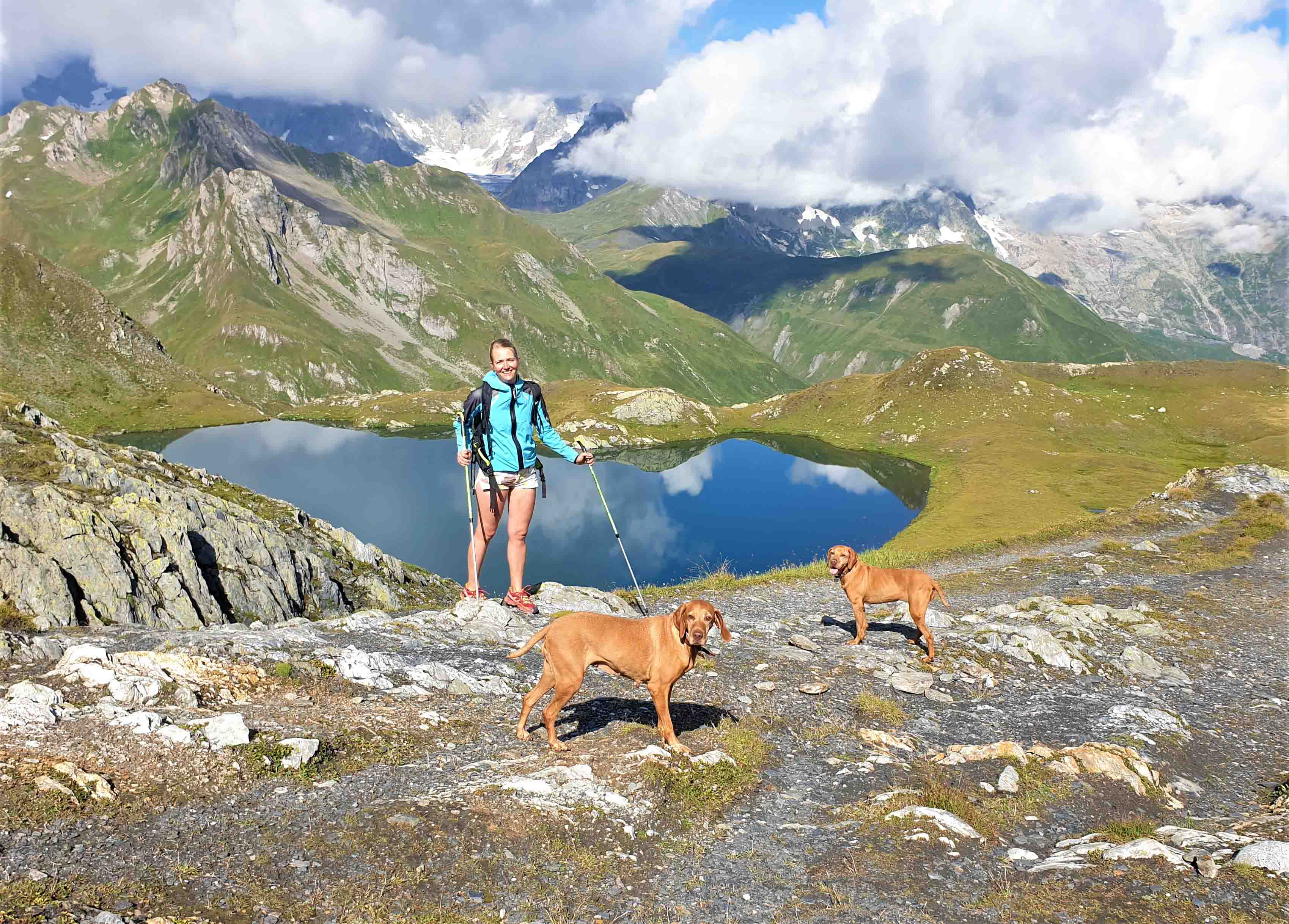
A spectacular Alpine hike along the border between Switzerland and Italy, with a view of the Mont Blanc massif and the neighbouring peaks.
The hike starts at the St. Bernard Pass, just on the border between Switzerland and Italy.
1. From the col du Fenêtre de Ferret you can already see the lakes below but above all you have a breathtaking view of the Mont Blanc massif and the Mont Dolent right in front of you! Firstly, you will see two of the three Lacs de Fenêtre (one is hidden behind a ridge) sparkling in a greenish blue, against the backdrop of the Monts Telliers and the Col de l’Arpalle.
2. The rocky ridge up on the right looks impassible and at first it is hard to see where the Col des Bastillon goes. The descent from the pass to the lakes of Lé is much gentler than on the other side! The stony path winds gently towards the lakes. There are 3 lakes Lé, but they are much less well known than the lacs de fenêtre, but they are as well very pretty.
3. Then take the path upwards and through the scree to the Col des Chevaux. The path is never steep but climbs in broad sweeps, it is easy to imagine pack horses being taken this way. Remember to look behind you as the higher that you ascend the more that you Mont Dolent as it become visible behind the Col des Bastillon.
4. Follow the path downhill to where it joins the road on the Swiss side of the Grand St Bernard Pass just before the hospice.
Elevation: +1050m - 1050m
Time: 6 h.
Zerbion peak (2772m)
 From the top Zerbion peak, due is central position, there is a very wide view on all the most important summits of the Aosta Valley, Gran Paradiso Group, Monte Bianco Group, Cervino, Monte Rosa Group
We start from Barmasc village, (1.828m). The path is very nice, sometime steep, and crosses, after a wile, a quite wide channel named Ru Cortod;
After the small bridge, the path is in a bush of pick pines; the last part of the path, that you simply hike, brings to the Portola Pass, (2.415m). Despite the 600m of level from the beginning, usually you reach the pass in a quite short time, the path from a certain point is very steep. The view on the Ayas valley is magnificent; from the pass you see also the other face of the mountain.
Hiking, the view enlarges: you have in front the summits of the central Aosta Valley, and as soon as you arrive on the wide ridge, on your left and behind you, appear the whole Monte Rosa Group and the Cervino; when you arrive to the top, it seems that you can touch these mountains with your hands.
Elevation: +1000m - 1000m
Time to going up: 3 h.
From the top Zerbion peak, due is central position, there is a very wide view on all the most important summits of the Aosta Valley, Gran Paradiso Group, Monte Bianco Group, Cervino, Monte Rosa Group
We start from Barmasc village, (1.828m). The path is very nice, sometime steep, and crosses, after a wile, a quite wide channel named Ru Cortod;
After the small bridge, the path is in a bush of pick pines; the last part of the path, that you simply hike, brings to the Portola Pass, (2.415m). Despite the 600m of level from the beginning, usually you reach the pass in a quite short time, the path from a certain point is very steep. The view on the Ayas valley is magnificent; from the pass you see also the other face of the mountain.
Hiking, the view enlarges: you have in front the summits of the central Aosta Valley, and as soon as you arrive on the wide ridge, on your left and behind you, appear the whole Monte Rosa Group and the Cervino; when you arrive to the top, it seems that you can touch these mountains with your hands.
Elevation: +1000m - 1000m
Time to going up: 3 h.
Aosta Valley
Vetan (1795m) - M. Faler Shelter (2385m) - Fenetre Pass (2729m)
 The route is ideal for both adults and children. Starting in the village of Vetan, approximately 30 minutes from Aosta, the entire route offers breathtaking views of the mountain peaks. Throughout the journey, you'll come across wooden sculptures of various sizes, serving as excellent motivation for children (wooden birds on trees, mushrooms, hedgehogs, foxes, human sculptures).
The hike to the mountain refuge takes approximately 1.45 to 2 hours.
At the Mon Falère refuge, the rooms are comparable to a 3-star hotel, making it a suitable place to stay overnight. On the next day, you can ascend one of the peaks.
The route is ideal for both adults and children. Starting in the village of Vetan, approximately 30 minutes from Aosta, the entire route offers breathtaking views of the mountain peaks. Throughout the journey, you'll come across wooden sculptures of various sizes, serving as excellent motivation for children (wooden birds on trees, mushrooms, hedgehogs, foxes, human sculptures).
The hike to the mountain refuge takes approximately 1.45 to 2 hours.
At the Mon Falère refuge, the rooms are comparable to a 3-star hotel, making it a suitable place to stay overnight. On the next day, you can ascend one of the peaks.
 For those who still have energy after reaching the shelter, you can ascend to the mountain lake (50 minutes) or hike to the Fenetre Pass, offering breathtaking views of the opposite side of the valley.
Elevation gain: +590m (from Vetan to M. Faler shelter) +344m (from M. Faler shelter to Fenetre Pass)
Time for ascent: 2 hours (from Vetan to M. Faler shelter) 1 hour (from M. Faler shelter to Fenetre Pass)
For those who still have energy after reaching the shelter, you can ascend to the mountain lake (50 minutes) or hike to the Fenetre Pass, offering breathtaking views of the opposite side of the valley.
Elevation gain: +590m (from Vetan to M. Faler shelter) +344m (from M. Faler shelter to Fenetre Pass)
Time for ascent: 2 hours (from Vetan to M. Faler shelter) 1 hour (from M. Faler shelter to Fenetre Pass)

